
On the 19th and 20th of October 2013, a community-level workshop was held on the use of Global Positioning System (GPS) device to map community resources, to be claimed under the Forest Rights Act of 2006. The training was held in the village of Niapania in Keonjhar district in Odisha, India. Organized by Keonjhar Integrated Rural Development and Training Institute (KIRDTI), an NGO based in Keonjhar, in collaboration with Natural Justice, the workshop saw the participation of around 40 persons from different blocks within Keonjhar as well as from other districts of Orissa. Stella James and Kishore Kumar Patnaik (Fellows, Natural Justice) participated in the workshop and assisted in the coordination of the workshop.
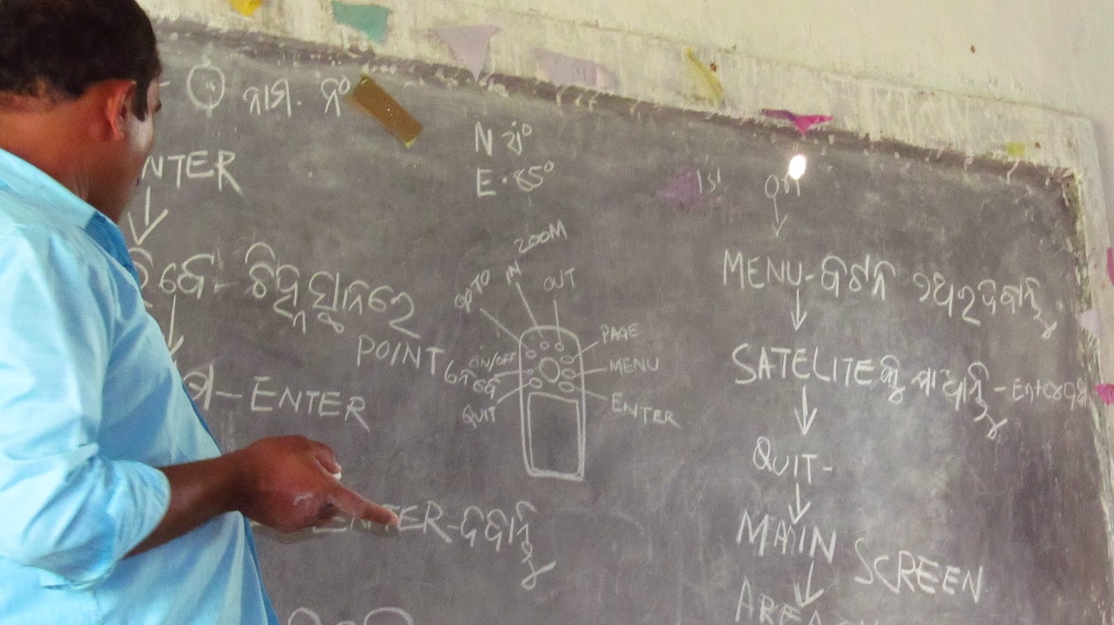 Mr Adikand Ojha from Bhubaneswar, who acted as the resource person, started with a brief description of the GPS device to the participants, as well as of the advantages of using it. One of the advantages pointed out to the villagers was that while earlier people used to draw maps freehand, or use complicated manual methods of measurement, with a GPS, measurement of land becomes simpler and much more accurate. Moreover, once measurements are taken, the GPS also allows one to see the roads and other waypoints from any part of the world.
After this, all the participants divided themselves into three groups and practiced taking measurements with the GPS, in a nearby field. The groups spent around3-4 hours learning different practical aspects of GPS measurement, after which the day closed with a session on clarifications.
The first day’s training was followed up on the 20th at the office of KIRDTI in Keonjhar. This involved learning how to download the map drawn in the GPS, as well as how to integrate these maps into online satellite mapping portals such as Google Earth, and send the maps to persons in other locations. The participants also learnt how to colour coordinate the downloaded map and also how to mark the locations of resources to be identified under FRA such as play ground, cultivable land, trees, products of forest, hamlets, place of worship, rivers and streams, grazing area, etc. as well as distances from place to place.

The device will be helpful to villagers and also to government officials for identification of individual and community rights under FRA; it will also speed up the process of FRA implementation. This device is available in almost all electronic shops and can also be availed from the GARMIN website (for devices produced by German company, GARMIN).
No comments:
Post a Comment