Showing posts with label Participatory Mapping. Show all posts

Tuesday, October 22, 2013

GPS Training in Odisha


On the 19th and 20th of October 2013, a community-level workshop was held on the use of Global Positioning System (GPS) device to map community resources, to be claimed under the Forest Rights Act of 2006. The training was held in the village of Niapania in Keonjhar district in Odisha, India. Organized by Keonjhar Integrated Rural Development and Training Institute (KIRDTI), an NGO based in Keonjhar, in collaboration with Natural Justice, the workshop saw the participation of around 40 persons from different blocks within Keonjhar as well as from other districts of Orissa. Stella James and Kishore Kumar Patnaik (Fellows, Natural Justice) participated in the workshop and assisted in the coordination of the workshop. 
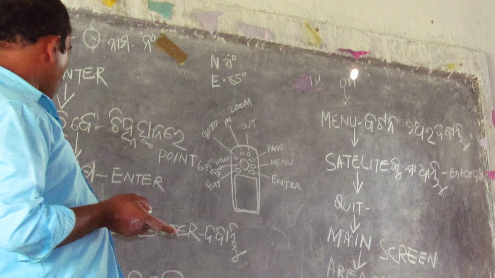
Mr Adikand Ojha from Bhubaneswar, who acted as the resource person, started with a brief description of the GPS device to the participants, as well as of the advantages of using it. One of the advantages pointed out to the villagers was that while earlier people used to draw maps freehand, or use complicated manual methods of measurement, with a GPS, measurement of land becomes simpler and much more accurate. Moreover, once measurements are taken, the GPS also allows one to see the roads and other waypoints from any part of the world. 

Thursday, October 17, 2013

Village Meeting on the Forest Rights Act in Odisha

On 15th and 16th October 2013, Stella James (Fellow, Natural Justice) attended a village meeting held at the Bhudabhuin Community Centre in the Sundergarh district of the state of Odisha, India. The meeting revolved around a discussion of the Forest Rights Act 2006 (FRA), a landmark legislation in terms of granting customary rights over resources to adivasis (tribals) and other forest dwellers. The meeting was attended by approximately 60 persons, from different villages, some people travelling many kilometers by foot through thick forests, walking almost an entire day to attend the meeting. 

The meeting was facilitated by Jitendra Sahu, an advocate who has been working in Odisha on successful implementation of FRA in many areas of Odisha. Jitubhai, as he is popularly known, talked about the significant difference between the FRA and previous legislations on forests. In his own words, the crucial distinction is the inclusion of the word ‘right’ between the words ‘forest’ and ‘act’, thus finally marking a departure from the previously parochial understanding of all forest land belonging to the State. He emphasized how adivasis and other forest dwellers are now legally ‘owners’ and ‘right-holders’ of the forests in which they live, and not merely watchmen. Jitubhai also deftly explained some of the main provisions of the Act, without bogging the villagers with too much jargon or technicality, which may have tended to dissuade enthusiastic participation. 

Thursday, July 4, 2013

Participatory Mapping Workshop in Melangkap

From 29 June to 1 July, Holly Shrumm (Natural Justice) joined Borneo Conservancy Initiative for the first of a series of participatory mapping workshops with the villages of Melangkap (Sabah, Malaysia). The workshop involved sketch mapping by each of the five villages, comparisons of certain overlapping areas and common resources, and a basic introduction to taking Global Positioning System (GPS) points with hand-held units.

Subsequent workshops will involve creating 2-D and 3-D maps on the basis of GPS points currently being collected, and as part of an ongoing process to document and develop a community protocol.